
Open Course › Course 2 › Module 7 · Building the APSE soundscape archive
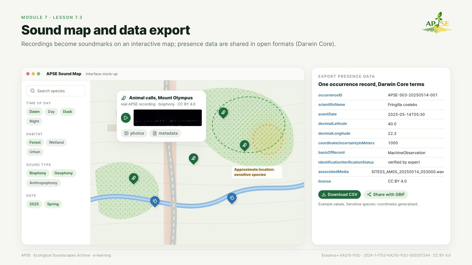
Figure 7.3. Sound map and data export. Recordings become soundmarks on a map; presence data are shared in open formats.
The interactive sound map. Each recording becomes a point on the map, a “soundmark”, with a player, metadata and photos. Filters (date, time of day, habitat, species, biophony, geophony, anthropophony) let users explore the territory and compare places.
Maps in space and time. Repeated recordings make it possible to build maps that show how soundscapes change from place to place and from hour to hour, season to season. Researchers, park authorities and educators can compare sites without being there and quickly find the recordings that contain the species they are interested in.
Data export. Presence data (species, date, time, place, confidence, who validated it) should be exportable in open formats such as CSV. The Darwin Core standard, used by the Global Biodiversity Information Facility (GBIF), is the common language for sharing species occurrence data with the scientific community.
Sensitive data. For sensitive species (for example nesting raptors or wolf dens), show only an approximate location, to avoid disturbance and poaching.
Watch: Global Biodiversity Information Facility (GBIF) walkthrough (Nic Tippery, YouTube). Third-party video embedded from YouTube; it is not covered by the course licence (CC BY 4.0).


Funded by the European Union. Views and opinions expressed are however those of the author(s) only and do not necessarily reflect those of the European Union or the Agenzia Italiana per la Gioventù. Neither the European Union nor the granting authority can be held responsible for them.
APSE · Erasmus+ KA210-YOU · 2024-1-IT03-KA210-YOU-000257244 · Licence CC BY 4.0 · Free and open: no registration needed.
